NID Embarks on Watershed Restoration to Protect Water Supply
Addressing a changing climate by restoring a montane meadow

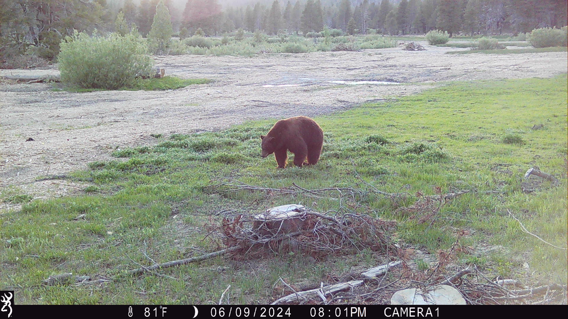
The northern Sierra Nevada mountain range is immense; it’s more than 39,000 square miles of forests, creeks, rivers and lakes which supply a vast majority of California’s water. These watersheds are threatened by large, severe wildfires as we have seen in the past decade, which in turn puts the water that flows from them at risk. Within this vast network of watersheds, the Nevada Irrigation District (NID) is restoring and enhancing approximately 200 acres of montane meadow habitat and another 175 acres of white and red fir forest roughly 21 miles northwest of Truckee. Why the fuss over this postage stamp in the Sierra?
The restoration project is part of NID’s efforts to protect its source watersheds and adapt its water system to a changing climate, which threatens our future supply of drinking and agricultural water. The work also supports the important ecological and hydrological function of high-elevation meadows. The English Meadow Restoration Project is funded by the Wildlife Conservation Board’s Forest Conservation Program, and joins a growing movement to restore meadows in the Sierra Nevada region of California.
This restoration project has multiple goals. NID has developed a multifaceted approach that aims to improve montane meadow hydrology; reduce sediment delivery into Jackson Meadows Reservoir; and protect rare and declining wildlife habitat in the Sierra Nevada from climate impacts, including catastrophic wildfire.
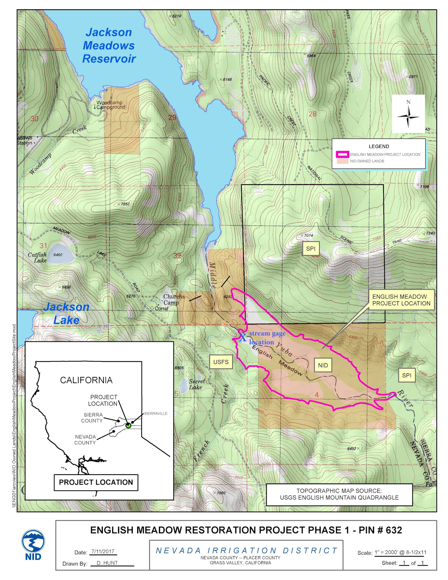
English Meadow is located in the headwaters of the Middle Yuba River just upstream of Jackson Meadows Reservoir and roughly six miles upstream of Milton Reservoir, both of which are owned and operated by NID. The Middle Yuba River watershed comprises the majority of approximately 70,000 acres of high-elevation watersheds that NID uses to provide water resources throughout Nevada County, and down to the area surrounding Lincoln. At an elevation of 6,140 feet, the meadow sits in the shadow of English Mountain (elevation 8,373), the tallest peak in the watershed.
The meadow is age-old, formed when Ice Age glaciers carved out the Sierra Nevada range, and the Middle Yuba River headwaters began flowing through the meadow and down into the foothills.
Native American communities lived in the Sierra Nevada for thousands of years. NID has worked with local Tribes to accomplish restoration goals of watershed health and habitat protection now and into the future.

In 1856-58, a mining company built a large timber dam, and the meadow was inundated, sunken under the bottom of the reservoir basin. In 1883, in a purported act of sabotage, the dam was dynamited. Some 15,000 acre-feet instantly became a forceful wall of water 40 feet high that rushed down the river canyon, devastating all property and habitat in its path before flooding Marysville and ultimately reaching Sacramento.
After the dam ruptured, left behind was the sedimented reservoir basin and the remnants of the former meadow. The river channel became incised and disconnected from the floodplain, fracturing how water moved downstream, and increasing the velocity at which water entered and exited the meadow system. The incised channel became very flashy and erosive, which invited upland trees and vegetation such as lodgepole pine to encroach upon what used to be wet meadow habitats. Conifer encroachment, artificially constructed drainage ditches, and numerous headcutting tributaries contribute to a drying trend that would convert the once wet meadow into an arid grassland and eventually a lodgepole pine thicket. Because montane meadows are rare and important watershed features in the Sierra Nevada mountain range, it is of paramount importance to ensure their continued function and protection from the risk of catastrophic wildfire.
Today, NID’s focus is to restore and protect the 200 acres of montane meadow to once again function as a healthy meadow. The project has been many years in the making, and work has just ended for this year.

The effort has included reconnecting the English Meadow floodplain and the channel of the Middle Yuba River by raising the elevation of the channel with woody debris and cobble structures. These structures are essentially large log jams aimed at slowing and spreading water from the mainstem channel out into remnant channels and the floodplain during spring runoff. The effort also has aimed to improve forest health and wildfire resilience by removing small diameter ladder or fire fuels within and adjacent to the meadow basin. Reducing stand density and the subsequent intensity of wildfire protects montane meadow habitats and downstream water security and quality.
Neysa King, NID’s Environmental Resources Administrator, says the rehabilitation work is an inspiring and exciting undertaking. “Working to restore English Meadow has been an amazing endeavor over the last eight years. We have partnered with other agencies -- the Wildlife Conservation Board and Sierra Nevada Conservancy -- for grant funding, natural resource experts, local contractors, local Tribes, and universities to survey and assess this incredible part of the Middle Yuba watershed.”
“We know that water comes from watersheds, and our goal is to support healthy and functional watersheds into the future. With creative and pragmatic design, we have brought expert forest managers and operators into a remote area where onsite materials were used to restore the connection between the river and its floodplain. We are confident that this process facilitation, combined with a significantly thinned forest stand, will improve the hydrology, habitats and wetland communities in this beautiful meadow. Post-project monitoring and our long-term commitment will allow us to observe changes and to adaptively manage this meadow for long-term watershed health. As they say, wet meadows and floodplains are water in the bank,” King said.
A changing climate changes everything
Climate change refers to long-term alteration in global average temperatures and weather patterns, specifically it relates to temperature and precipitation.
NID’s mountainous upper watershed acts as a natural reservoir, releasing snowmelt runoff during the spring and summer months. The District’s water storage and delivery system was designed and is currently operated to take advantage of the historic snow cycle and the timing of the resulting runoff.
However, warming temperatures make it more likely that precipitation will fall as raindrops, rather than snowflakes. As a result, due to NID’s operational reliance on winter snowpack, climate change has potential for a profound effect on the District’s water reliability and, in turn, more pressure on how water is managed to ensure delivery to customers.
The meadow restoration is part of the solution to a changing climate that threatens the water supply to the Sierra foothills. King explained the vital role of a healthy montane meadow: “spongy soils soak up snowmelt, hold it in the ground until mid-summer, and then releases that water into rivers and streams to be used by downstream plants, fish, animals and people. In the face of a warming climate, which is diminishing the amount of snow, a meadow can be considered water in the bank, saved to be used later when it is needed. Another way of saying it is this meadow restoration will benefit the ecosystem and increase upstream water storage that will be available to grow crops and for use by people.”
English Meadow Restoration & Enhancement Project: what does it take to re-establish the meadow?
This project has been ongoing for eight years, and this fall it entered the final construction stages. Preceding the restoration, hydrologic disconnection of the floodplain and river channel, as well as erosion at the most upstream part of tributary creeks (called headcutting), has contributed to the drying out and decline of the historic meadow.
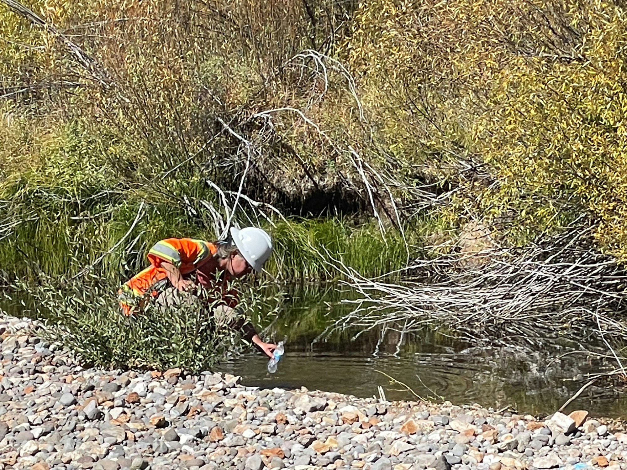
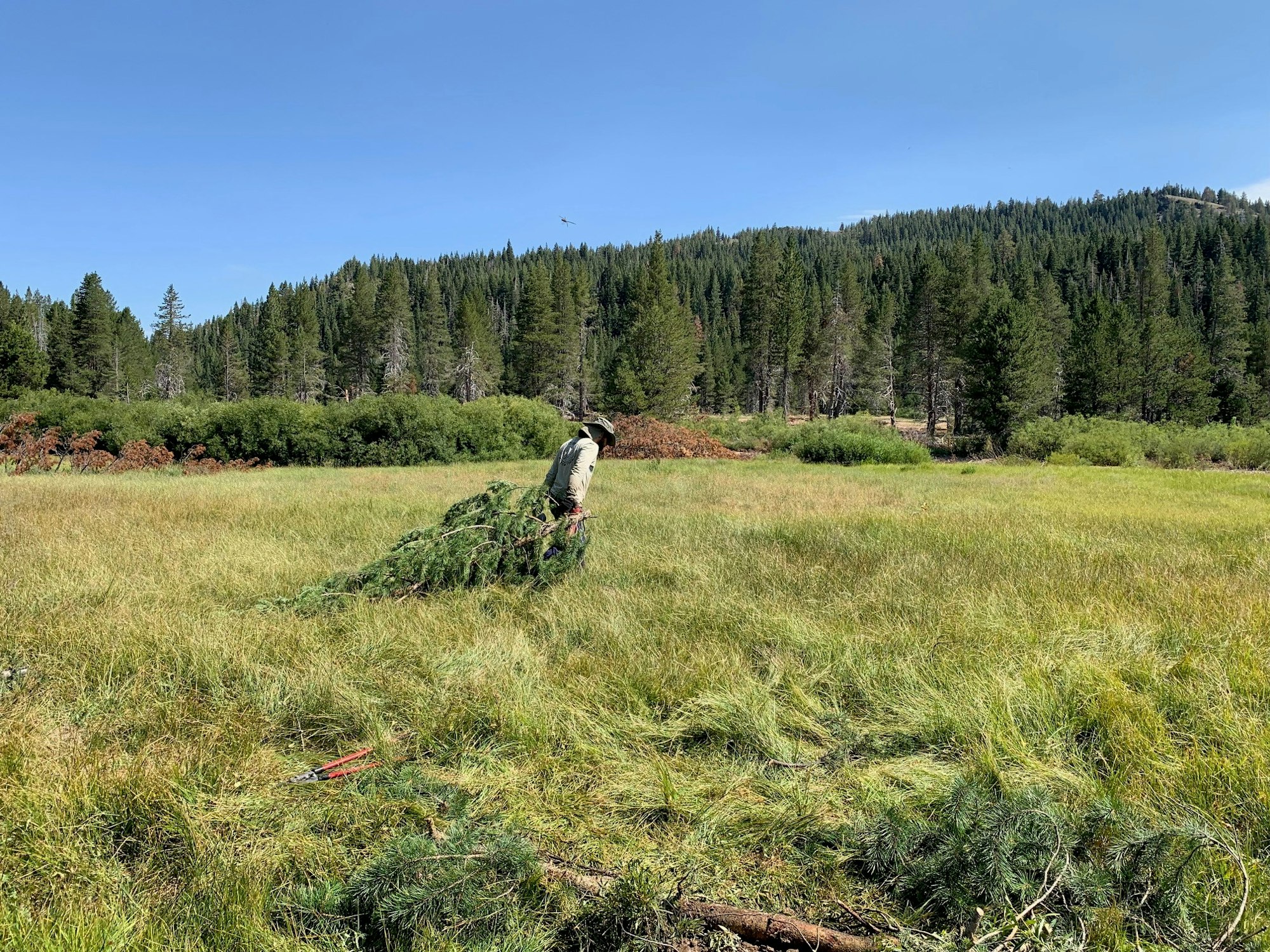
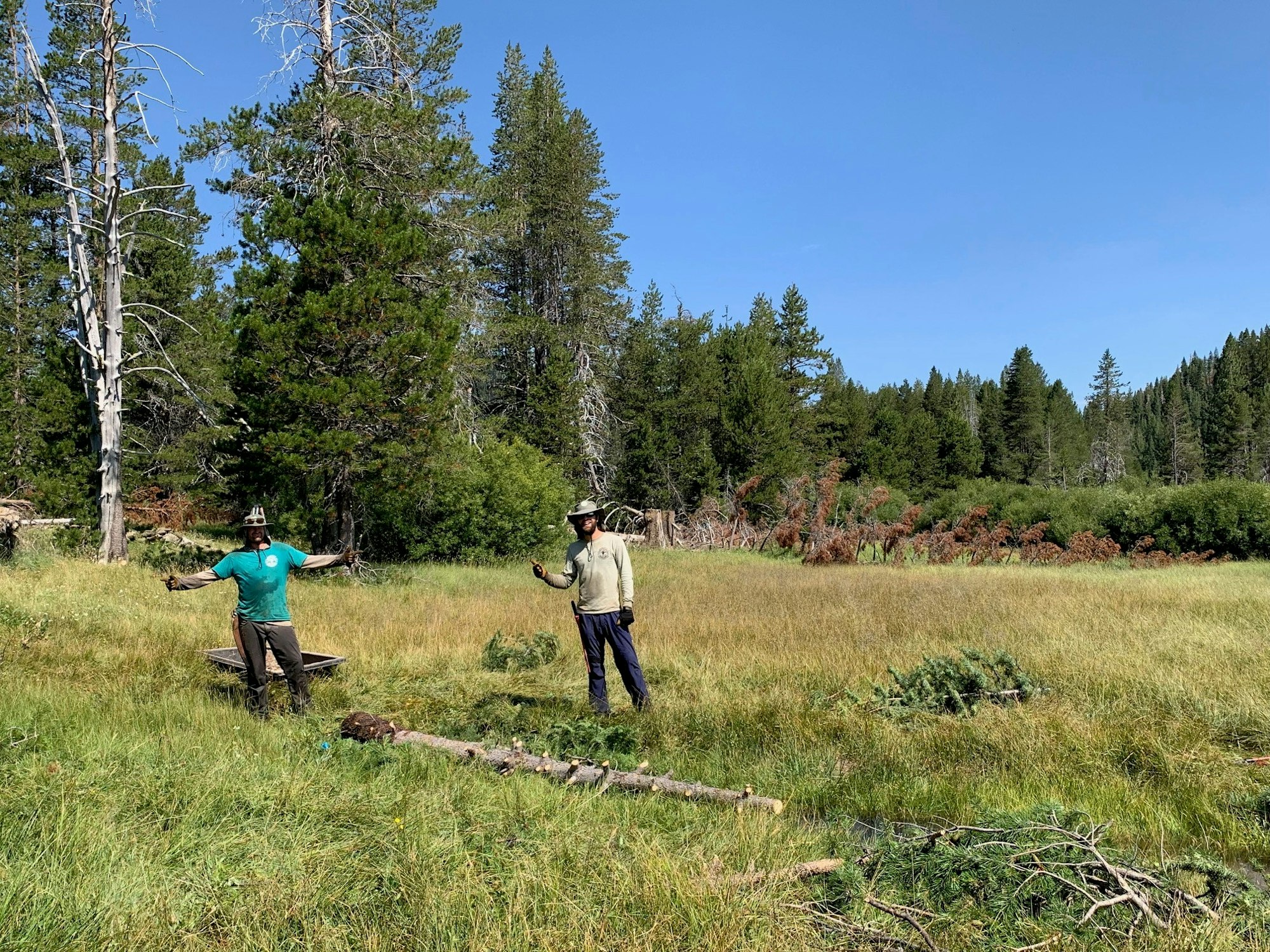
There are several aspects to this project. Restoration includes constructing a series of locally sourced woody debris structures in the Middle Yuba River channel; raising the river channel and subsequently the water table to re-activate the meadow floodplain and improve hydrology. NID is treating and filling dewatering channels and headcutting tributaries to promote the spread of surface and groundwater flow and reduce the transport of sediment into downstream reservoirs. Lodgepole pine trees from within the meadow basin were utilized to construct debris structures, create erosion barriers throughout the meadow and its tributaries, and were strategically placed to prevent straight-line cattle trailing as well as prevent cattle from entering sensitive features on site like fens and springs.
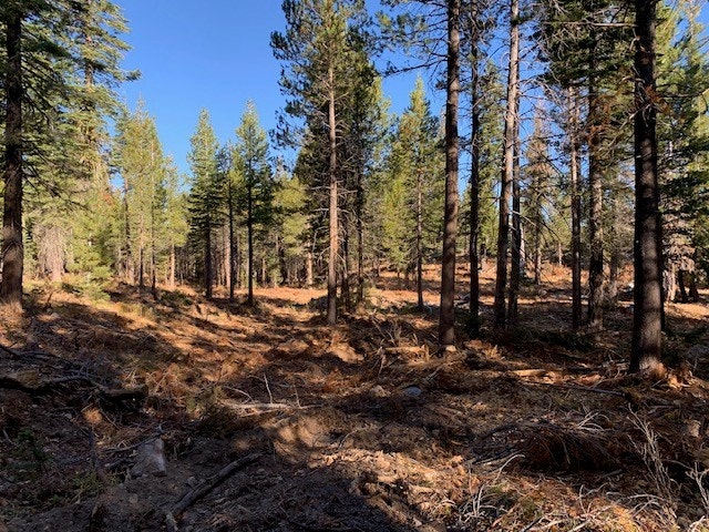
In addition, the project involves thinning 175 acres of dense understory forest vegetation on the slopes surrounding the meadow to improve forest health and decrease the risk of extreme wildfire. Reducing fire fuels has the dual benefit of protecting forest habitats as well as the meadow from potential impacts of catastrophic wildfire which is the single largest threat to headwaters watersheds in California.
NID has coordinated with State and Federal regulatory agencies and locally affiliated Tribes in the planning, permitting and implementation stages of the restoration project.
The Wildlife Conservation Board and the Sierra Nevada Conservancy have been instrumental in making this NID project possible. The agencies have provided $1.5 million, collectively, to support the expansion of forest management practices to create healthier and more resilient ecosystems in the Yuba River watershed.
“Montane meadow environments are critical features throughout the high elevation of the Sierra Nevada region, providing refuge habitats for terrestrial and aquatic communities,” King explained. “Today we realize that these meadows are valuable and justify public investment to restore, monitor and manage them as parts of functional headwaters watersheds. This NID project not only is restoring a vital, rare meadow, it will serve as precedent for further rehabilitation projects.”
English Dam – the California Gold Rush
The California Gold Rush in 1848 spurred on a frenzied push into the foothills and upper reaches of the Sierra. Some estimates indicate 300,000 people arrived to California to strike it rich. Instantly, life changed for the native Tribes throughout the ancestral lands of English Meadow and the Middle Yuba River. The landscape was changing in every way.
English Meadow was completely changed seven years after the Gold Rush began when a 79-foot-tall wooden crib dam was built at the downstream end of the meadow. The resulting reservoir, the largest in the state at the time, completely inundated 395 acres, roughly 2.5 miles long by one-half mile wide.
The owners, Sierra Nevada Water and Mining Company, were commonly referred to as “the English Company,” and, as a result, the designation became “English Dam” – it was also called Rudyard Dam -- and “English Meadow.”
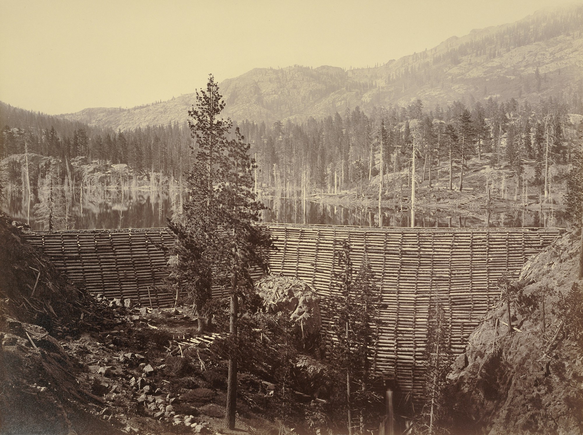
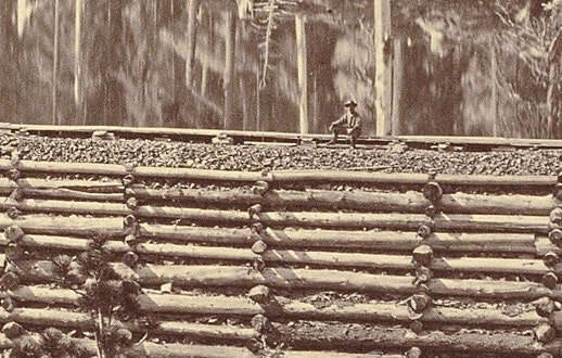
The company used the water to power the cannons of hydraulic mining, which drew flows from the high-elevation reservoir to downstream nozzles, called monitors. The monitors blasted the hillsides with high-pressure jets of water in the search of gold. Displaced gravels were washed through sluices, and the gold settled behind riffle boards. The remaining debris would be flushed down the river.
In 1867, the North Bloomfield Gravel Mining Company purchased English Reservoir to supply water to North San Juan for the Malakoff Diggins. The dam was rebuilt in 1876 with reinforced stone to a height of 131 feet that expanded reservoir capacity to 15,000 acre-feet of water. That powered what was the largest hydraulic mining site in California. In fact, between 1866 and 1884, Malakoff operations excavated 41 million cubic yards of gravel and yielded $3.5 million worth of gold (at a price of $17 per ounce).
Catastrophe hit at 5 AM on June 18, 1883. The English Dam watchman reported hearing two violent explosions, and then water began pouring through a wide breach in the upper cribwork. The dam then failed, sending nearly 15,000 acre-feet of water – the amount of water in 7,500 Olympic-sized swimming pools -- and debris crashing down the entire canyon of the Middle Yuba River from the mountains all the way to Marysville and into Sacramento. The breach produced an estimated discharge of more than 166,000 cubic feet per second, and the resulting flood wave caused a rise of 40 feet at a point 43 miles below the dam. The resulting debris flows into the South Yuba River buried the towns of Marysville and Yuba City under 25 feet of mud and rock.
Countless lives were saved because the watchman had access to a telephone, and called to warn of the disaster, which would hit inhabited downstream areas within hours. It was the world's first long-distance telephone line, developed in 1880 to service Malakoff Diggins, passing through North Bloomfield from French Corral to Bowman Lake.
With the reservoir drained and English Meadow under a mountain of sediment, the meadow was nothing like what it was, by looks or function. The violent dam break greatly impacted the Middle Yuba River through the meadow. It initiated the incision of the stream channel and disconnect from the meadow floodplain. This incision has grown each spring when high river flows follow melting snow and spring rain, causing the channel to erode and cut down into the unstable sediment that was deposited back when the reservoir was created. Today the river almost never spills out over the meadow floodplain, which is a normal rewetting process in functional montane meadows.
Cattle grazing
The English Meadow valley floor has been used to graze cattle for more than a century. At the beginning of the 1900s, many foothill ranchers would drive their livestock into the high Sierra Nevada every summer as the lower elevations heated up and pastures dried up. Without a reliable water source to the foothills, including Penn Valley and all of southern Nevada County, the ranchers’ best option was to, literally, find greener pastures about 60 miles and 4,000 vertical feet upward from their ranches.
In 1917, local ranchers Kate Church and her husband Munson “Bert” drove their cattle up to the English Meadow area. On this cattle drive, Kate envisioned a water system where the abundant waters of the high mountains could be carried to ranches in the foothills so they would have a reliable source of water year-round.
The Churches were among a group of local residents who started a campaign to form an irrigation district. The effort proved successful, and by popular vote of the people in 1921 the Nevada Irrigation District was formed. Water rights to the Middle Yuba River, including the English Dam site, were acquired in the 1920s. And the District started providing irrigation water to ranches and farmers in Nevada and Placer counties in the mid-1920s.
From the early days, grazing cattle had an impact. With the aim of drying out the meadow soils to allow for better grazing, drainage cuts were dug on the north and south slopes of the English Meadow location. These drainage cuts led to the dieback of riparian plant species in that area and contributed to the encroachment of lodgepole pine and the reduction of flora diversity in the meadow. It was a complete habitat conversion, from a periodically inundated wetland meadow to a dry, degraded and eroding grassland.
Logging in the headwaters
The history of logging followed by decades of fire suppression and lack of management of the forest vegetation, have resulted in densely overgrown forests in many parts of the Sierra Nevada region.
Throughout the decades the history of logging has included periods of overharvesting and more recently, periods when forest management was curbed to an extreme. When combined with wildfire suppression, forests that evolved with frequent wildfires have become unhealthy, as neither natural burn cycles nor mechanical thinning (e.g. selective logging, sustainable harvesting, etc.) occurred. Today there are millions of acres of over-stressed forests with elevated wildfire risk due to the dense forest stands, volume of dead and downed wood, and widespread forest die-off from disease and beetles.
In short, a dense forest community reduces snow accumulation and subsequent surface runoff, while also consuming more water resources. Within the meadow, lodgepole pine and other conifers have become established in the drying soils, further contributing to the seasonal depletion of the meadow aquifer. In combination, overly dense forests and accumulating dead woody material increase the risk of catastrophic wildfire, which threatens to further impact the meadow and surrounding forest communities.
These conditions were observed on the slopes around English Meadow during the early site assessment. While working with a local forester, District staff developed a plan to improve forest health and to utilize the trees in riverine structures which would have hydrologic benefits in this headwaters region. The District contracted with meadow restoration experts to design and oversee the project, and with local timber operators to achieve this challenging, creative and exciting project for watershed health and the long-term security of our water supply.
The value of meadow restoration
As California continues to shift to a warmer and more frequently burned landscape, functional watersheds will become critical to our future water resources. Mountain meadow health has been prioritized in the Sierra Nevada due to their connection to overall water quality and quantity in headwater systems. Improving the functionality of areas like English Meadow allows more water and sediment to remain within the floodplain and aquifer, rather than being carried downstream during peak flow periods in the spring.
This meadow restoration is part of NID’s commitment to delivering water to agricultural and domestic customers today and well into the future.
Through regional partnerships, such as with the Wildlife Conservation Board and Sierra Nevada Conservancy, NID is able to address the needs of the watersheds in its care and work to fulfill its stewardship goals.
Tasked with providing a sustainable supply of water for our growing communities, “NID is always looking to the future to ensure that there will be water when we need it. With the changing climate causing less snowfall and more rainfall, it is more important than ever to be managing our watershed to ensure reliable water supply,” said NID General Manager Jennifer Hanson.
Read more about the project on NID’s meadow restoration webpage.
PHOTO GALLERY


